U.S. Road Signs: Destination signs 2026
D1 series Destination

A D1-1 series destination guide sign listing a town or place name with a directional arrow, helping drivers find the way toward their destination.

A single-line destination guide sign naming one place with a directional arrow, pointing drivers toward that destination at a junction.

A one-line destination sign that adds the mileage, showing both the direction to a place and how far away it is.

A single-line bicycle destination sign with a directional arrow, guiding cyclists along a bike route toward a named place.

A one-line bicycle destination sign that also lists the distance, directing riders toward a place and showing how far it is.
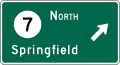
A single-line destination sign with a route shield for a roundabout, showing which roundabout exit leads to the named destination.
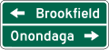
A two-line destination guide sign listing two places with arrows, directing drivers toward each destination from a junction.
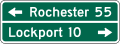
A two-line destination sign that includes mileage, showing the direction and distance to two named places.
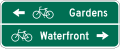
A two-line bicycle destination sign with arrows, guiding cyclists toward two named places along a bike route.
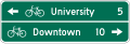
A two-line bicycle destination sign listing distances, directing riders toward two places and showing how far each is.
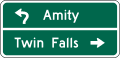
A two-line destination sign for a roundabout, showing which exits of the circular intersection lead to each named place.
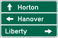
A three-line destination guide sign listing three places with directional arrows to help drivers navigate a multi-way junction.
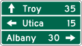
A three-line destination sign with mileage, showing the direction and distance to three separate named destinations.
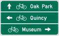
A three-line bicycle destination sign with arrows, guiding cyclists toward three named places along the bike route.
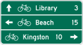
A three-line bicycle destination sign listing distances, pointing riders toward three destinations and how far each lies ahead.
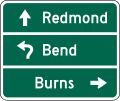
A three-line destination sign for a roundabout, indicating which circular-intersection exits lead to each of three named places.
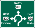
A diagrammatic destination sign for a roundabout, using a map-like layout to show which exits lead to listed destinations.
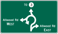
A diagrammatic roundabout destination sign that sketches the circular intersection and its exits toward the named destinations.
D2 series Distance

A single-line distance sign listing one destination with its mileage, telling drivers how far it is along the current road.
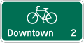
A single-line bicycle distance sign showing the mileage to one destination along a designated bike route.
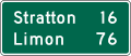
A two-line distance sign listing two destinations with their mileages so drivers know how far each lies ahead.
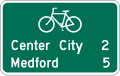
A two-line bicycle distance sign giving the mileage to two destinations along the bike route.
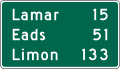
A three-line distance sign listing three destinations with their mileages, a roadside reference to how far each place is.
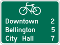
A three-line bicycle distance sign showing mileage to three destinations along a designated bike route.
D3 series Street name

A street name sign identifying the roadway at an intersection, helping drivers and pedestrians locate and confirm streets.

A street name sign that also displays a route shield, showing both the street name and the numbered route it carries.
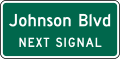
A two-line advance street name sign posted before an intersection, alerting drivers to the cross street they are approaching.
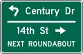
A three-line advance street name sign giving early notice of an upcoming cross street so drivers can prepare to turn.
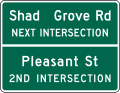
A four-line advance street name sign providing advance notice of an intersection and its cross street to approaching drivers.
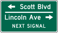
A three-line advance street name sign, an alternate layout warning drivers of the cross street ahead so they can plan a turn.
D4 series Parking
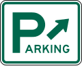
A parking area guide sign directing drivers to a public parking facility, often with an arrow pointing the way.
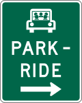
A Park and Ride sign marking a lot where commuters can leave their vehicle and continue by bus, rail, or carpool.
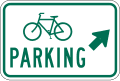
A bicycle parking area sign guiding cyclists to a designated place where bikes can be parked.
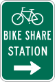
A bicycle-sharing station sign pointing to a location where riders can rent or return shared bicycles.
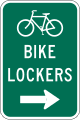
A bicycle lockers sign directing cyclists to secure, enclosed storage where bicycles can be locked away.
D5 series Rest area
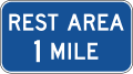
A rest area sign showing the distance to an upcoming highway rest stop with restrooms and parking.
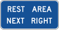
A rest area sign indicating the facility is at the next exit or entrance on the right.

A rest area sign with a diagonal right arrow marking the exit or ramp that leads into the rest stop.
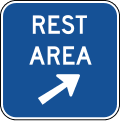
A rest area gore sign placed at the ramp exit point, marking the final entrance to the rest area.
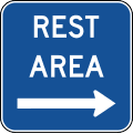
A rest area sign identifying a highway rest stop where drivers can pull off to rest and use restroom facilities.
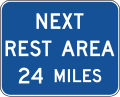
A next rest area sign showing the mileage to the following rest stop, helping drivers plan when to stop.
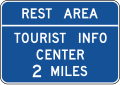
A rest area and tourist information center sign showing the distance ahead to a stop offering travel information.
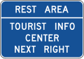
A rest area and tourist information center sign indicating the facility is at the next exit on the right.
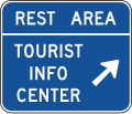
A rest area and tourist information center sign with a diagonal right arrow marking the exit into the facility.
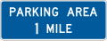
A parking area sign showing the distance ahead to a highway parking facility.
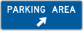
A parking area sign with a diagonal right arrow pointing to the exit that leads into the parking facility.
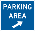
A parking area gore sign at the ramp exit point, marking the final entrance to the parking facility.
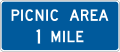
A picnic area sign showing the distance ahead to a roadside stop with picnic tables and facilities.
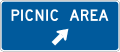
A picnic area sign with a diagonal right arrow directing drivers to the exit for the picnic stop.
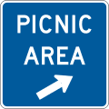
A picnic area gore sign at the ramp divergence, marking the final entrance to the picnic area.
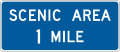
A scenic area sign showing the distance ahead to a viewpoint or scenic overlook where drivers can stop.

A scenic area sign with a diagonal right arrow marking the exit that leads to a scenic viewpoint.
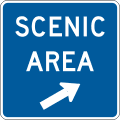
A scenic area gore sign at the ramp exit point, marking the final entrance to the scenic overlook.
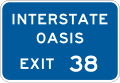
An Interstate Oasis sign marking an approved facility with fuel, food, restrooms, and truck parking accessible from the interstate.
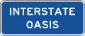
An Interstate Oasis plaque mounted with a guide sign, identifying an approved full-service traveler facility along the interstate.
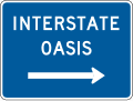
An Interstate Oasis sign identifying a designated facility offering fuel, food, restrooms, and parking for interstate travelers.
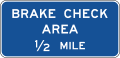
A brake check area sign showing the distance ahead to a pullout where truckers and drivers can inspect brakes before a long grade.
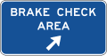
A brake check area sign with a diagonal right arrow marking the exit into a pullout for checking brakes before a downgrade.
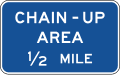
A chain-up area sign showing the distance ahead to a pullout where drivers can install tire chains in winter conditions.
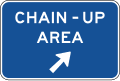
A chain-up area sign with a diagonal right arrow marking the exit into a pullout for fitting tire chains.
D8 series Weigh station
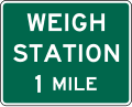
A weigh station sign showing the distance ahead to a facility where trucks must stop to be weighed and inspected.
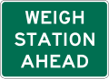
Alerts drivers of trucks that a weigh station lies ahead, giving commercial vehicles time to prepare to exit and be checked for weight and safety.
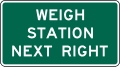
Tells truck drivers that the weigh station is reached by taking the next right, where commercial vehicles must pull in when the station is open.
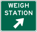
Points toward the weigh station with a diagonal right arrow, guiding commercial vehicles onto the ramp leading into the inspection facility.
D10 series Reference location
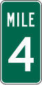
A single-digit reference location marker posted along the roadway to help drivers and responders pinpoint their position by mileage.

An intermediate single-digit reference marker placed between whole-mile posts to give a more precise fix on your location.

A two-digit reference location marker showing the mileage point along the highway, useful for reporting breakdowns or crashes accurately.

An intermediate two-digit reference marker set between mile posts, letting drivers report a location with fractional-mile accuracy.
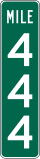
A three-digit reference location marker indicating the mileage point on longer routes so you can note exactly where you are.

An intermediate three-digit reference marker positioned between full mileposts to refine location reporting on high-mileage highways.
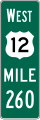
An enhanced reference location marker combining the route number with mileage, giving both roadway identity and position at a glance.
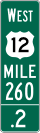
An intermediate enhanced reference marker showing route and fractional mileage between main mileposts for more exact location reporting.
D11 series Bicycle facility and shared-use path
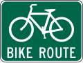
Marks a designated bike route, confirming to cyclists that the road or path is part of an established bicycle network.

A supplemental plaque mounted with a bike route sign to add direction, destination, or route-name detail for cyclists.
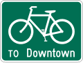
A bike route sign that also names a destination, helping cyclists follow the network toward a specific place.

A single-line guide sign on a shared-use path pointing cyclists and walkers toward one named destination.
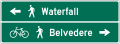
A two-line shared-use path guide sign directing trail users toward a pair of listed destinations.
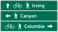
A three-line shared-use path guide sign listing several destinations to help trail users choose their way.

A single-line shared-use path sign giving one destination along with the distance remaining to reach it.
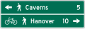
A two-line shared-use path sign showing two destinations and the distance to each for trail users.
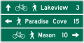
A three-line shared-use path sign listing multiple destinations with their distances to guide cyclists and pedestrians.
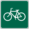
Indicates that bicycles are permitted on the facility or path where the sign is posted.
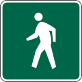
Shows that pedestrians are allowed to use the path or facility marked by the sign.
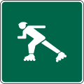
Signals that inline skaters are permitted to use the shared-use path where posted.
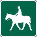
Indicates that equestrians on horseback are permitted to use the trail or shared-use path.
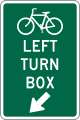
Marks a two-stage bicycle left-turn box at an intersection, showing cyclists where to wait to complete a protected left turn.
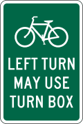
Advises cyclists that they may make a left turn using the marked two-stage turn box rather than merging across traffic.
D12 series Radio, telephone and carpool information
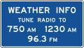
Tells motorists which radio frequency to tune for weather information along the route.
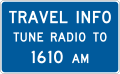
Directs drivers to a radio frequency broadcasting current traffic information for the area.

A supplemental plaque noting that the highway advisory radio carries an urgent message when its beacon is flashing.
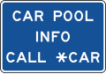
Provides carpool and ridesharing information, such as a phone number or frequency, to encourage shared commuting.
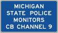
Advises drivers that CB radio Channel 9 is monitored in the area for emergency assistance.
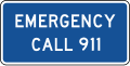
Reminds motorists to dial 911 to report an emergency along this stretch of road.
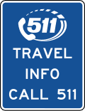
A pictograph sign telling travelers to call 511 for road and travel information.
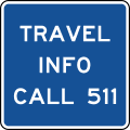
Directs travelers to dial 511 for statewide road conditions and travel information.
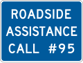
Points motorists to available roadside assistance, such as a service patrol phone number, for help with breakdowns.
D13 series Crossover and freeway entrance
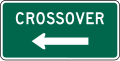
Identifies an authorized median crossover, typically for official or emergency use, on a divided highway.
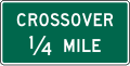
Gives advance notice of the distance to an authorized median crossover ahead on a divided highway.
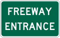
Marks the entrance to a freeway, confirming that the ramp ahead leads onto the limited-access highway.
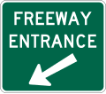
A variant freeway entrance sign directing drivers to the on-ramp for the limited-access highway.
D15 series Combination lane usedestination
.svg.png&w=256&q=75)
A combination sign pairing lane-use arrows with a route shield, showing which lane to take toward a numbered highway.
.svg.png&w=256&q=75)
A combination sign pairing lane-use arrows with a street name, telling drivers which lane leads to that street.
D17 series Truck lane and slow vehicle signs
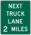
Gives advance notice of the distance to the next climbing or truck lane, where slow trucks can move right on grades.
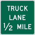
Announces the distance to a truck lane ahead, letting slower heavy vehicles keep right so others can pass.
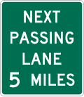
Tells drivers how far ahead the next passing lane begins, giving a chance to overtake slower traffic.
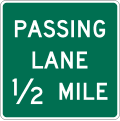
Marks the distance to a passing lane ahead where an added lane lets faster vehicles safely overtake.
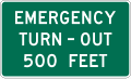
Advises the distance to an emergency turn-out ahead where disabled vehicles can pull safely off the road.
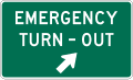
Points with a diagonal right arrow to an emergency turn-out just ahead for pulling off in a breakdown.
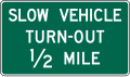
Gives the distance to a slow-vehicle turn-out where slower drivers should pull over to let traffic behind pass.

Have a question? Contact Us
Have questions about preparing for your DMV exam or need assistance with our tools? Reach out to us — we're here to help you succeed on your journey to getting your license

Send us a message
By sending this message, you agree to our terms and conditions.